
Map
Please scroll down to access the various maps we have available of the area. Note that the although we are now call the Malvern Hills National Landscape, our legal status is still Area of Outstand Natural Beauty (AONB).
The map below shows the AONB Boundary.
We also have a map of the Malvern Hills AONB Boundary, based on Ordnance Survey maps available for download
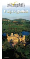
Our Visitor Map and Guide is available to download. Based on the ordnance survey map for the area, you’ll find it marked up with places to go to feed the mind, spirit and body. The free map is also available in print from places mentioned in the guide itself. Should you wish to stock this free leaflet, please get in touch with David Armitage.
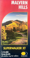
Harvey Maps have produced a 1:12,500 and 100% waterproof map of the Malvern Hills and some of the surrounding area.
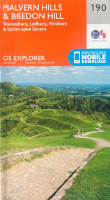
The Ordnance Survey has produced two 1:25,000 maps of the area, 190 Malvern Hills and Bredon Hill for the south and 204 Worcester and Droitwich Spa for the north of the AONB.
You can also find more information on our pages showing walks, bicycle rides , less abled access routes and themed guides to this National Landscape.